JPG
Esta foto
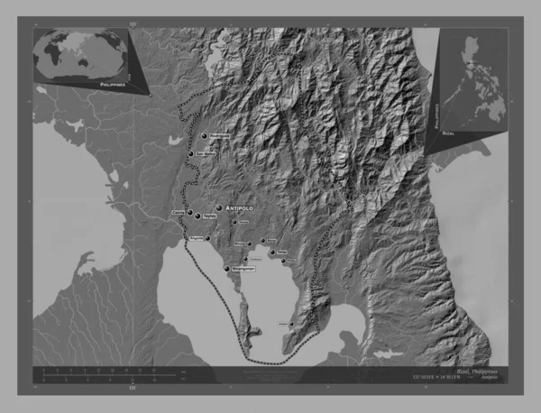
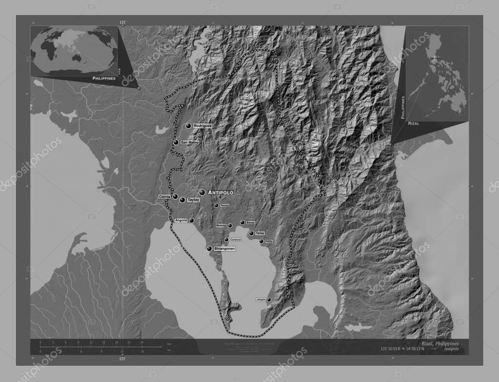
Rizal, province of Philippines. Bilevel elevation map with lakes and rivers. Locations and names of major cities of the region. Corner auxiliary location maps.
Datos de la Imįgen (tiene derechos de autor*)
- Fotografķa:
Rizal, province of Philippines. Bilevel elevation map with lakes and rivers. Locations and names of major cities of the region. Corner auxiliary location maps
- Autor:
- Ancho original:
4930 pķxeles.
- Altura original:
3770 pķxeles.
- Tamańo:
18.59 megapķxeles.
- Categorķas:
- Palabras Clave:
Manila contorno san mateo binangonan estereogrįfico Territorio Cardona malanday Morong esquema frontera océano Zoom: pililla Capital social Rodrķguez Teresa Baras Rizal región Tierras Filipinas tierra angono Continente Antipolo jalajala Cainta phl Naturaleza división administrativa provincia planeta Tanay paķs mundo Taytay geografķa Atlas forma Asia Ciencia Leyenda mapa .
Popularidad
- Vistas:
- 2
- Descargas:
- 0
Fotos similares
Otros temas con fotografķas que le puede interesar
- angono
- Morong
- planeta
- Manila
- Ciencia
- paķs
- Cardona
- Territorio
- forma
- Teresa
- Capital social
- Rizal
- san mateo
- Naturaleza
- esquema
- Antipolo
- Tierras
- pililla
- océano
- Zoom:
- región
- mapa
- estereogrįfico
- provincia
- binangonan
- Taytay
- Leyenda
- phl
- tierra
- Cainta
- mundo
- Baras
- Asia
- división administrativa
- malanday
- Filipinas
- Tanay
- frontera
- Rodrķguez
- contorno
- jalajala
- Atlas
- Continente
- geografķa
(*) Sitio para adquirir: Link externo para Comprar
Fotografķa de Rizal, province of Philippines. Bilevel elevation map with lakes and rivers. Locations and names of major cities of the region. Corner auxiliary location maps, que incluye Rizal, province of Philippines. Bilevel elevation map with lakes and rivers. Locations and names of major cities of the region. Corner auxiliary location maps.
Todas las imįgenes por Depositphotos
Este sitio usa imįgenes de Depositphotos