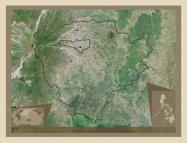
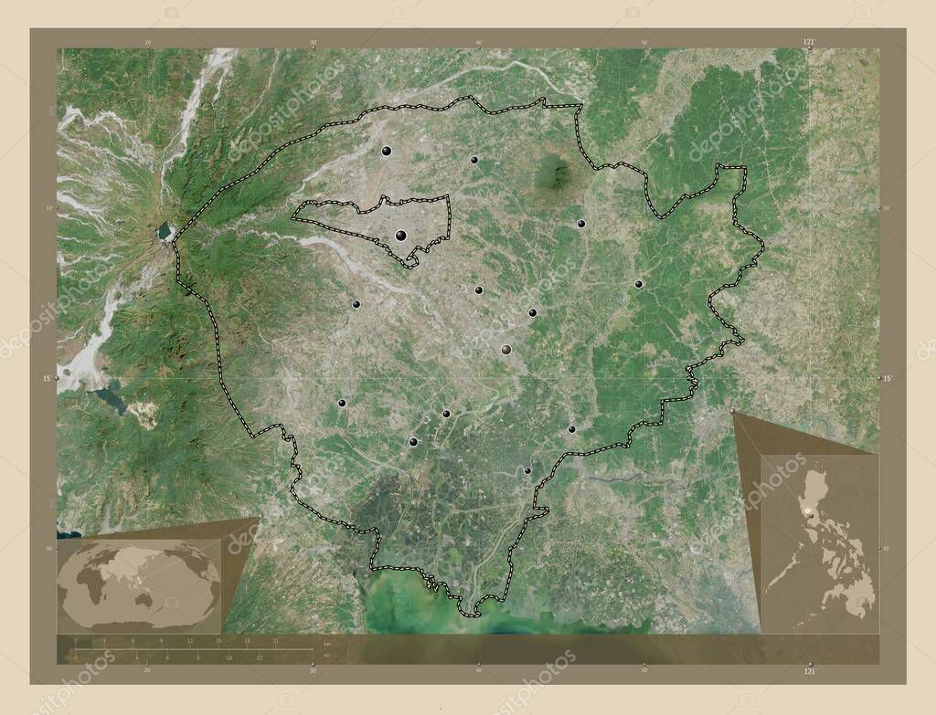
Pampanga, province of Philippines. High resolution satellite map. Locations of major cities of the region. Corner auxiliary location maps
Esta foto
Pampanga, province of Philippines. High resolution satellite map. Locations of major cities of the region. Corner auxiliary location maps.
Datos de la Imágen (tiene derechos de autor*)
- Fotografía:
Pampanga, province of Philippines. High resolution satellite map. Locations of major cities of the region. Corner auxiliary location maps
- Autor:
- Ancho original:
4930 píxeles.
- Altura original:
3770 píxeles.
- Tamańo:
18.59 megapíxeles.
- Categorías:
- Palabras Clave:
phl planeta candaba estereográfico Atlas Zoom: Pampanga mundo esquema provincia poraco Naturaleza Mabalacat Capital social apalit Ciencia Territorio Tierras Asia forma Filipinas bulaon frontera Manila país Arayat geografía tierra Leyenda océano Macabebe contorno lubao Continente mapa división administrativa Ángeles mexicana san fernando magalang región Guagua .
Popularidad
- Vistas:
- 1
- Descargas:
- 0
Fotos similares
Otros temas con fotografías que le puede interesar
- Ciencia
- Asia
- Filipinas
- san fernando
- estereográfico
- bulaon
- contorno
- Arayat
- región
- magalang
- mexicana
- océano
- provincia
- Continente
- división administrativa
- Manila
- planeta
- Ángeles
- candaba
- lubao
- mundo
- Pampanga
- apalit
- Territorio
- geografía
- Mabalacat
- forma
- Macabebe
- tierra
- esquema
- mapa
- Zoom:
- Guagua
- Atlas
- phl
- Naturaleza
- poraco
- Capital social
- frontera
- país
- Leyenda
- Tierras
(*) Sitio para adquirir: Link externo para Comprar
Fotografía de Pampanga, province of Philippines. High resolution satellite map. Locations of major cities of the region. Corner auxiliary location maps, que incluye Pampanga, province of Philippines. High resolution satellite map. Locations of major cities of the region. Corner auxiliary location maps.
Todas las imágenes por Depositphotos