JPG
Esta foto
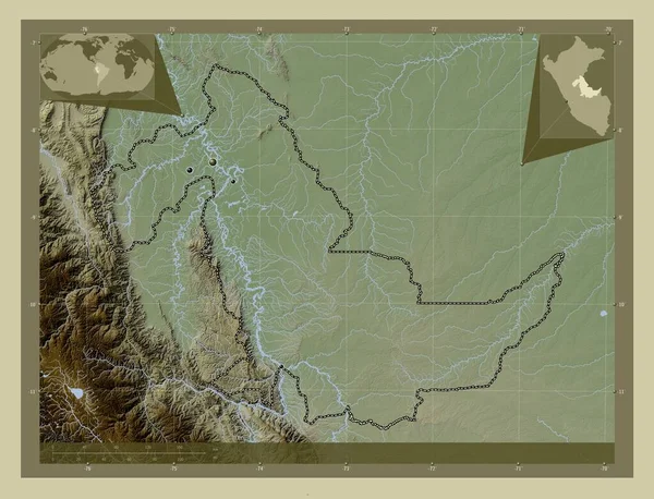
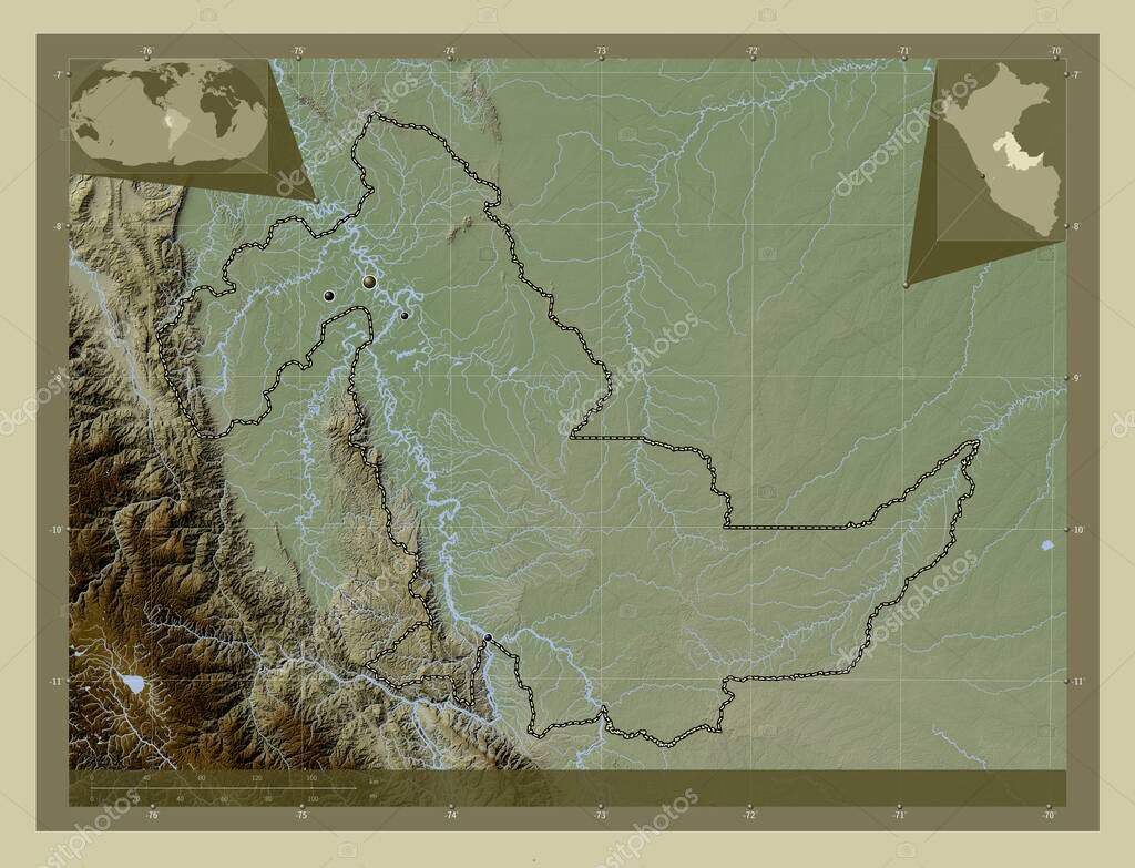
Ucayali, region of Peru. Elevation map colored in wiki style with lakes and rivers. Locations of major cities of the region. Corner auxiliary location maps.
Datos de la ImŠgen (tiene derechos de autor*)
- FotografŪa:
Ucayali, region of Peru. Elevation map colored in wiki style with lakes and rivers. Locations of major cities of the region. Corner auxiliary location maps
- Autor:
- Ancho original:
4930 pŪxeles.
- Altura original:
3770 pŪxeles.
- TamaŮo:
18.59 megapŪxeles.
- CategorŪas:
- Palabras Clave:
Territorio mapa pucallpa ocťano mundo masisea perķ estereogrŠfico Por tierra Tierras planeta forma Capital social paŪs regiůn esquema ucayali frontera Leyenda Ciencia geografŪa Continente Lima Zoom: Atlas Atalaya contorno Amťrica del Sur Naturaleza campo verde divisiůn administrativa .
Popularidad
- Vistas:
- 0
- Descargas:
- 0
Fotos similares
Otros temas con fotografŪas que le puede interesar
- ocťano
- estereogrŠfico
- tierra
- Naturaleza
- mundo
- Continente
- Atalaya
- Lima
- Atlas
- campo verde
- Ciencia
- ucayali
- forma
- perķ
- Leyenda
- mapa
- divisiůn administrativa
- Territorio
- regiůn
- contorno
- paŪs
- esquema
- masisea
- Tierras
- pucallpa
- Por
- planeta
- geografŪa
- Zoom:
- Capital social
- Amťrica del Sur
- frontera
(*) Sitio para adquirir: Link externo para Comprar
FotografŪa de Ucayali, region of Peru. Elevation map colored in wiki style with lakes and rivers. Locations of major cities of the region. Corner auxiliary location maps, que incluye Ucayali, region of Peru. Elevation map colored in wiki style with lakes and rivers. Locations of major cities of the region. Corner auxiliary location maps.
Todas las imŠgenes por Depositphotos
Este sitio usa imŠgenes de Depositphotos