JPG
Esta foto
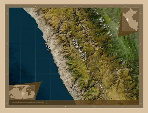
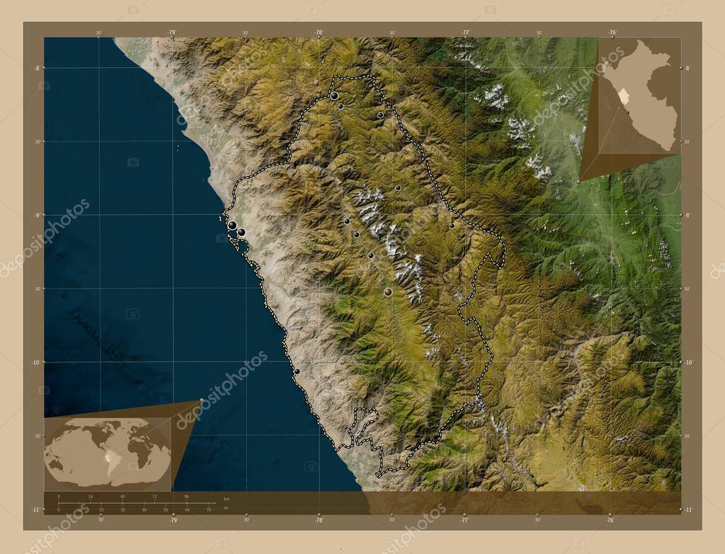
Ancash, region of Peru. Low resolution satellite map. Locations of major cities of the region. Corner auxiliary location maps.
Datos de la Imßgen (tiene derechos de autor*)
- FotografÝa:
Ancash, region of Peru. Low resolution satellite map. Locations of major cities of the region. Corner auxiliary location maps
- Autor:
- Ancho original:
4930 pÝxeles.
- Altura original:
3770 pÝxeles.
- Tama˝o:
18.59 megapÝxeles.
- CategorÝas:
- Palabras Clave:
divisiˇn administrativa acobamba carash contorno Por Pampa Carhuaz Atlas AmÚrica del Sur paÝs Caraz mapa forma nuevo chimbote Lima Zoom: conchucos geografÝa planeta frontera huarmey Ciencia pomabamba Naturaleza Ancash mundo tierra Territorio ocÚano Tierras esquema Leyenda estereogrßfico chimpancÚ mirgas Capital social Huaraz yongay regiˇn per˙ Continente .
Popularidad
- Vistas:
- 0
- Descargas:
- 0
Fotos similares
Otros temas con fotografÝas que le puede interesar
- mirgas
- esquema
- frontera
- contorno
- Lima
- nuevo chimbote
- Territorio
- yongay
- mapa
- Zoom:
- Ancash
- per˙
- acobamba
- planeta
- geografÝa
- chimpancÚ
- conchucos
- Carhuaz
- Atlas
- estereogrßfico
- Capital social
- Por
- paÝs
- tierra
- regiˇn
- Ciencia
- carash
- Tierras
- ocÚano
- pomabamba
- Caraz
- Continente
- Huaraz
- huarmey
- mundo
- forma
- AmÚrica del Sur
- Naturaleza
- divisiˇn administrativa
- Pampa
- Leyenda
(*) Sitio para adquirir: Link externo para Comprar
FotografÝa de Ancash, region of Peru. Low resolution satellite map. Locations of major cities of the region. Corner auxiliary location maps, que incluye Ancash, region of Peru. Low resolution satellite map. Locations of major cities of the region. Corner auxiliary location maps.
Todas las imßgenes por Depositphotos
Este sitio usa imßgenes de Depositphotos