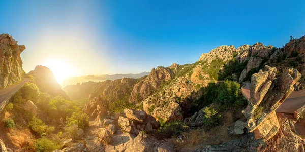
sunset aerial 360 degrees panorama of the road D824 route of the Piana Badlands. Les Calanques of Piana, a natural park of Corsica on the Mediterranean sea by the Porto Ota town.
Esta foto
Sunset aerial 360 degrees panorama of the road D824 route of the Piana Badlands. Les Calanques of Piana, a natural park of Corsica on the Mediterranean sea by the Porto Ota town..
Datos de la Imágen (tiene derechos de autor*)
- Fotografía:
sunset aerial 360 degrees panorama of the road D824 route of the Piana Badlands. Les Calanques of Piana, a natural park of Corsica on the Mediterranean sea by the Porto Ota town.
- Autor:
- Ancho original:
6080 píxeles.
- Altura original:
3040 píxeles.
- Tamaño:
18.48 megapíxeles.
- Categorías:
- Palabras Clave:
viajes porto ota RUTA ESCENICA francés costa carretera vista del dron 360 grados Mar Mediterráneo exterior Francia visitas turísticas viaje Cañón UNESCO rocas Puesta de sol calanques of piana acantilados parque Atracción turística turismo ciprés Córcega Naturaleza Montañas calle gente Vista superior Corse Europa Tour Calanques turísticas isla Panorama Países Bajos europeo escénica Malvinas porto corsica Granito Vista aérea destino de viaje D824 route Piana .
Popularidad
- Vistas:
- 1
- Descargas:
- 0

Fotos similares
Otros temas con fotografías que le puede interesar
- calle
- Malvinas
- Granito
- calanques of piana
- gente
- Cañón
- Piana
- porto corsica
- escénica
- Atracción turística
- Francia
- destino de viaje
- Córcega
- acantilados
- viaje
- visitas turísticas
- RUTA ESCENICA
- costa
- Mar
- ciprés
- Europa
- carretera
- Países Bajos
- isla
- Calanques
- Panorama
- Montañas
- Puesta de sol
- francés
- exterior
- UNESCO
- Vista superior
- Naturaleza
- vista del dron
- Mediterráneo
- Turismo
- Vista aérea
- Tour
- D824 route
- porto ota
- turísticas
- Viajes
- europeo
- 360 grados
- rocas
- parque
- Corse
(*) Sitio para adquirir: Link externo para Comprar
Fotografía de sunset aerial 360 degrees panorama of the road D824 route of the Piana Badlands. Les Calanques of Piana, a natural park of Corsica on the Mediterranean sea by the Porto Ota town., que incluye Sunset aerial 360 degrees panorama of the road D824 route of the Piana Badlands. Les Calanques of Piana, a natural park of Corsica on the Mediterranean sea by the Porto Ota town..
Todas las imágenes por Depositphotos