JPG
Esta foto
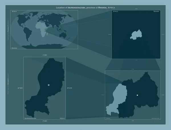
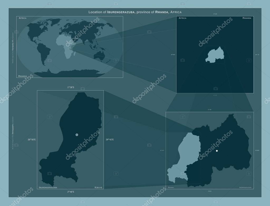
Iburengerazuba, province of Rwanda. Diagram showing the location of the region on larger-scale maps. Composition of vector frames and PNG shapes on a solid background.
Datos de la Imßgen (tiene derechos de autor*)
- FotografĒa:
Iburengerazuba, province of Rwanda. Diagram showing the location of the region on larger-scale maps. Composition of vector frames and PNG shapes on a solid background
- Autor:
- Ancho original:
4930 pĒxeles.
- Altura original:
3770 pĒxeles.
- Tama±o:
18.59 megapĒxeles.
- CategorĒas:
- Palabras Clave:
Atlas Kigali Territorio geografĒa divisi¾n administrativa ┴frica Ciencia iburengerazuba mapa provincia contorno Leyenda Naturaleza planeta Tierras frontera forma regi¾n esquema RWA estereogrßfico Zoom: Ruanda Capital social tierra Continente ocķano Kibuye mundo paĒs .
Popularidad
- Vistas:
- 0
- Descargas:
- 0
Fotos similares
Otros temas con fotografĒas que le puede interesar
- Kibuye
- Kigali
- planeta
- forma
- esquema
- Capital social
- Tierras
- Leyenda
- mundo
- contorno
- Zoom:
- Ruanda
- regi¾n
- tierra
- geografĒa
- divisi¾n administrativa
- Ciencia
- RWA
- provincia
- frontera
- Naturaleza
- Territorio
- ┴frica
- Atlas
- paĒs
- ocķano
- Continente
- mapa
- iburengerazuba
- estereogrßfico
(*) Sitio para adquirir: Link externo para Comprar
FotografĒa de Iburengerazuba, province of Rwanda. Diagram showing the location of the region on larger-scale maps. Composition of vector frames and PNG shapes on a solid background, que incluye Iburengerazuba, province of Rwanda. Diagram showing the location of the region on larger-scale maps. Composition of vector frames and PNG shapes on a solid background.
Todas las imßgenes por Depositphotos
Este sitio usa imßgenes de Depositphotos