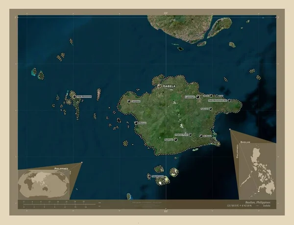
Basilan, province of Philippines. High resolution satellite map. Locations and names of major cities of the region. Corner auxiliary location maps
Esta foto
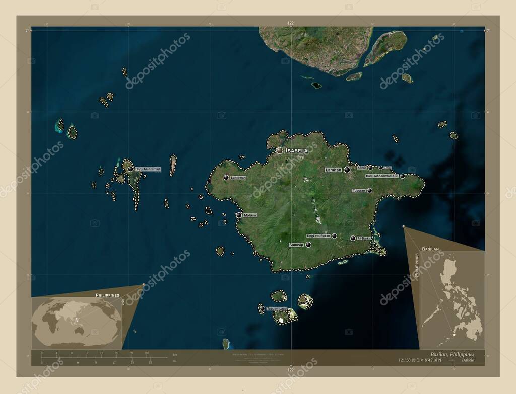
Basilan, province of Philippines. High resolution satellite map. Locations and names of major cities of the region. Corner auxiliary location maps.
Datos de la Imágen (tiene derechos de autor*)
- Fotografía:
-
Basilan, province of Philippines. High resolution satellite map. Locations and names of major cities of the region. Corner auxiliary location maps
- Autor:
- Ancho original:
-
4930 píxeles.
- Altura original:
-
3770 píxeles.
- Tamaño:
-
18.59 megapíxeles.
- Categorías:
-
- Palabras Clave:
-
Buton esquema Capital social Zoom: mundo Tierras mapa Celine región tabuan lasa hadji muhtamad maluso tipo tipo Ciencia océano tuburan división administrativa hadji mohammad ajul ungkaya pukan frontera estereográfico phl contorno basilán tierra geografía Naturaleza lantawan país Continente Territorio lamitano Manila Asia provincia Atlas sumisip al barka Filipinas planeta akbars Isabela forma Leyenda .
Popularidad
- Vistas:
- 0
- Descargas:
- 0
Fotos similares
Otros temas con fotografías que le puede interesar
- contorno
- hadji muhtamad
- Isabela
- Atlas
- Naturaleza
- hadji mohammad ajul
- tabuan lasa
- Leyenda
- tipo tipo
- al barka
- Celine
- planeta
- basilán
- ungkaya pukan
- sumisip
- lamitano
- Asia
- océano
- provincia
- región
- Ciencia
- lantawan
- frontera
- tierra
- mapa
- phl
- Continente
- Capital social
- Territorio
- akbars
- país
- Filipinas
- Manila
- Tierras
- Zoom:
- geografía
- esquema
- estereográfico
- Buton
- mundo
- forma
- tuburan
- división administrativa
- maluso
(*) Sitio para adquirir: Link externo para Comprar
Fotografía de Basilan, province of Philippines. High resolution satellite map. Locations and names of major cities of the region. Corner auxiliary location maps, que incluye Basilan, province of Philippines. High resolution satellite map. Locations and names of major cities of the region. Corner auxiliary location maps.
Todas las imágenes por Depositphotos