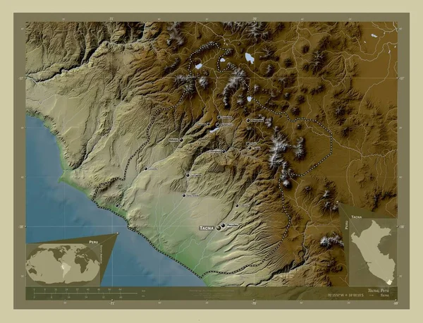
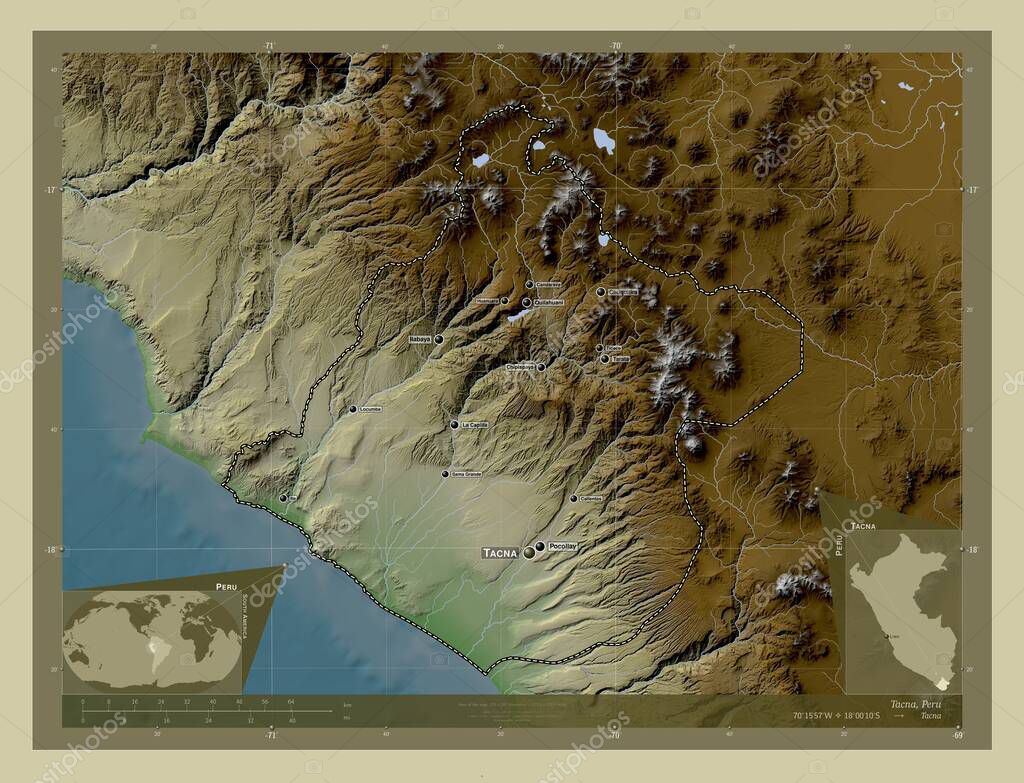
Tacna, region of Peru. Elevation map colored in wiki style with lakes and rivers. Locations and names of major cities of the region. Corner auxiliary location maps
Esta foto
Tacna, region of Peru. Elevation map colored in wiki style with lakes and rivers. Locations and names of major cities of the region. Corner auxiliary location maps.
Datos de la Imágen (tiene derechos de autor*)
- Fotografía:
-
Tacna, region of Peru. Elevation map colored in wiki style with lakes and rivers. Locations and names of major cities of the region. Corner auxiliary location maps
- Autor:
- Ancho original:
-
4930 píxeles.
- Altura original:
-
3770 píxeles.
- Tamaño:
-
18.59 megapíxeles.
- Categorías:
-
- Palabras Clave:
-
calientes ticaco forma Continente Naturaleza sobraya locumba contorno región chuquitira Ciencia Zoom: candarave planeta Comida Por pocollay tacna Tierras La Capilla mapa mundo Leyenda perú océano tarata estereográfico esquema América del Sur chipispaya Capital social sama grande Territorio tierra país Atlas Lima división administrativa huanuara geografía quilahuani ilabaya frontera .
Popularidad
- Vistas:
- 0
- Descargas:
- 0
Fotos similares
Otros temas con fotografías que le puede interesar
- Continente
- división administrativa
- región
- ticaco
- tarata
- mapa
- huanuara
- La Capilla
- candarave
- calientes
- contorno
- tierra
- pocollay
- Territorio
- Comida
- ilabaya
- océano
- sobraya
- Tierras
- Leyenda
- esquema
- forma
- país
- mundo
- Zoom:
- locumba
- perú
- Atlas
- América del Sur
- estereográfico
- chipispaya
- sama grande
- geografía
- quilahuani
- Naturaleza
- Por
- tacna
- frontera
- Ciencia
- chuquitira
- Lima
- Capital social
- planeta
(*) Sitio para adquirir: Link externo para Comprar
Fotografía de Tacna, region of Peru. Elevation map colored in wiki style with lakes and rivers. Locations and names of major cities of the region. Corner auxiliary location maps, que incluye Tacna, region of Peru. Elevation map colored in wiki style with lakes and rivers. Locations and names of major cities of the region. Corner auxiliary location maps.
Todas las imágenes por Depositphotos