JPG
Esta foto
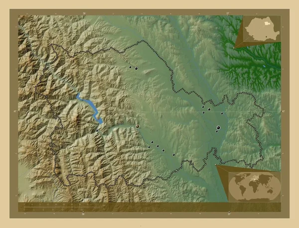
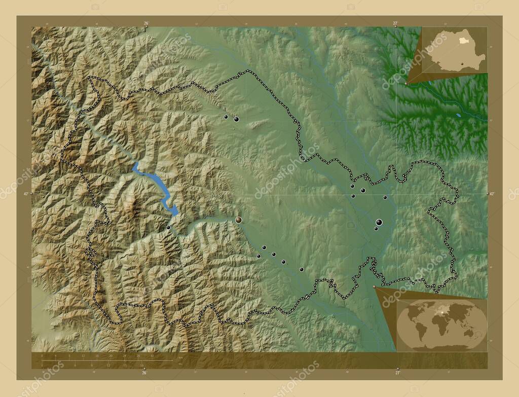
Neamt, county of Romania. Colored elevation map with lakes and rivers. Locations of major cities of the region. Corner auxiliary location maps.
Datos de la Imßgen (tiene derechos de autor*)
- FotografÝa:
Neamt, county of Romania. Colored elevation map with lakes and rivers. Locations of major cities of the region. Corner auxiliary location maps
- Autor:
- Ancho original:
4930 pÝxeles.
- Altura original:
3770 pÝxeles.
- Tama˝o:
18.59 megapÝxeles.
- CategorÝas:
- Palabras Clave:
podoleni savinesti forma Bucarest Horia frontera Rou zanesti geografÝa Europa ocÚano Ciencia esquema piatra neamt RumanÝa Capital social Tierras pildesti piatra soimului Neamt mundo paÝs Continente Zoom: Vinar˛s roznov sabaoani gheraesti Territorio estereogrßfico Romana Leyenda regiˇn provincia mapa Naturaleza contorno planeta tierra adjudeni divisiˇn administrativa tamaseni Atlas .
Popularidad
- Vistas:
- 0
- Descargas:
- 0
Fotos similares
Otros temas con fotografÝas que le puede interesar
- paÝs
- podoleni
- Rou
- Atlas
- geografÝa
- Territorio
- Leyenda
- Naturaleza
- savinesti
- adjudeni
- Tierras
- Bucarest
- Continente
- tamaseni
- Europa
- piatra soimului
- provincia
- frontera
- piatra neamt
- tierra
- regiˇn
- planeta
- Vinar˛s
- Zoom:
- Capital social
- forma
- Ciencia
- roznov
- gheraesti
- contorno
- RumanÝa
- Horia
- pildesti
- mapa
- ocÚano
- Romana
- sabaoani
- esquema
- divisiˇn administrativa
- mundo
- zanesti
- Neamt
- estereogrßfico
(*) Sitio para adquirir: Link externo para Comprar
FotografÝa de Neamt, county of Romania. Colored elevation map with lakes and rivers. Locations of major cities of the region. Corner auxiliary location maps, que incluye Neamt, county of Romania. Colored elevation map with lakes and rivers. Locations of major cities of the region. Corner auxiliary location maps.
Todas las imßgenes por Depositphotos
Este sitio usa imßgenes de Depositphotos