JPG
Esta foto
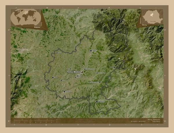
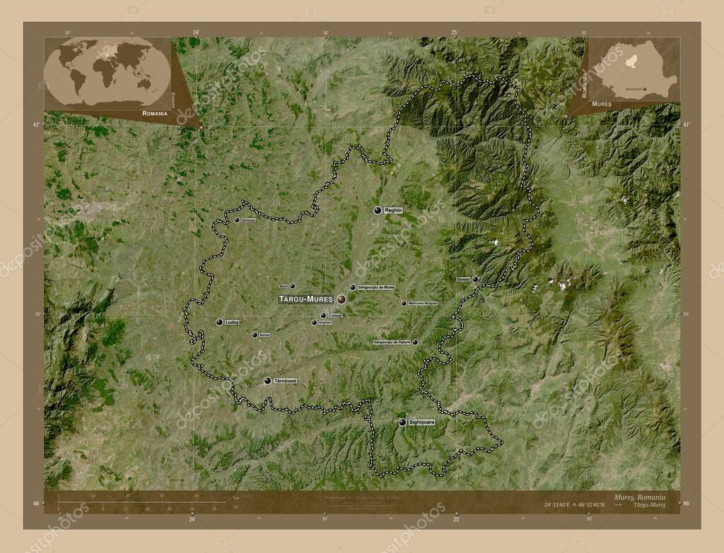
Mures, county of Romania. Low resolution satellite map. Locations and names of major cities of the region. Corner auxiliary location maps.
Datos de la Imßgen (tiene derechos de autor*)
- FotografÝa:
Mures, county of Romania. Low resolution satellite map. Locations and names of major cities of the region. Corner auxiliary location maps
- Autor:
- Ancho original:
4930 pÝxeles.
- Altura original:
3770 pÝxeles.
- Tama˝o:
18.59 megapÝxeles.
- CategorÝas:
- Palabras Clave:
ocÚano Zoom: Continente cristesti Capital social divisiˇn administrativa reghin Territorio planeta miercurea nirajului geografÝa sarmasu forma paÝs Lugo di romagna RumanÝa tarnaveni ungheni mundo provincia ganesti Sighisoara Leyenda Atlas mapa tierra sovata iernut frontera sancraiu de mures contorno sangeorgiu de mures Europa Naturaleza Bucarest Mures Tierras estereogrßfico banda Objetivos de la Uniˇn Europea sangeorgiu de padure Ciencia regiˇn Rou esquema .
Popularidad
- Vistas:
- 0
- Descargas:
- 0
Fotos similares
Otros temas con fotografÝas que le puede interesar
- ganesti
- Zoom:
- Mures
- RumanÝa
- mundo
- Ciencia
- ungheni
- sancraiu de mures
- sovata
- tierra
- sarmasu
- tarnaveni
- mapa
- frontera
- cristesti
- contorno
- estereogrßfico
- planeta
- Continente
- banda
- forma
- Tierras
- esquema
- Rou
- Capital social
- divisiˇn administrativa
- miercurea nirajului
- regiˇn
- Naturaleza
- iernut
- Territorio
- Atlas
- ocÚano
- Bucarest
- provincia
- geografÝa
- paÝs
- sangeorgiu de padure
- Sighisoara
- sangeorgiu de mures
- Objetivos de la Uniˇn Europea
- Lugo di romagna
- Europa
- Leyenda
- reghin
(*) Sitio para adquirir: Link externo para Comprar
FotografÝa de Mures, county of Romania. Low resolution satellite map. Locations and names of major cities of the region. Corner auxiliary location maps, que incluye Mures, county of Romania. Low resolution satellite map. Locations and names of major cities of the region. Corner auxiliary location maps.
Todas las imßgenes por Depositphotos
Este sitio usa imßgenes de Depositphotos