JPG
Esta foto
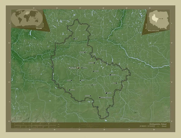
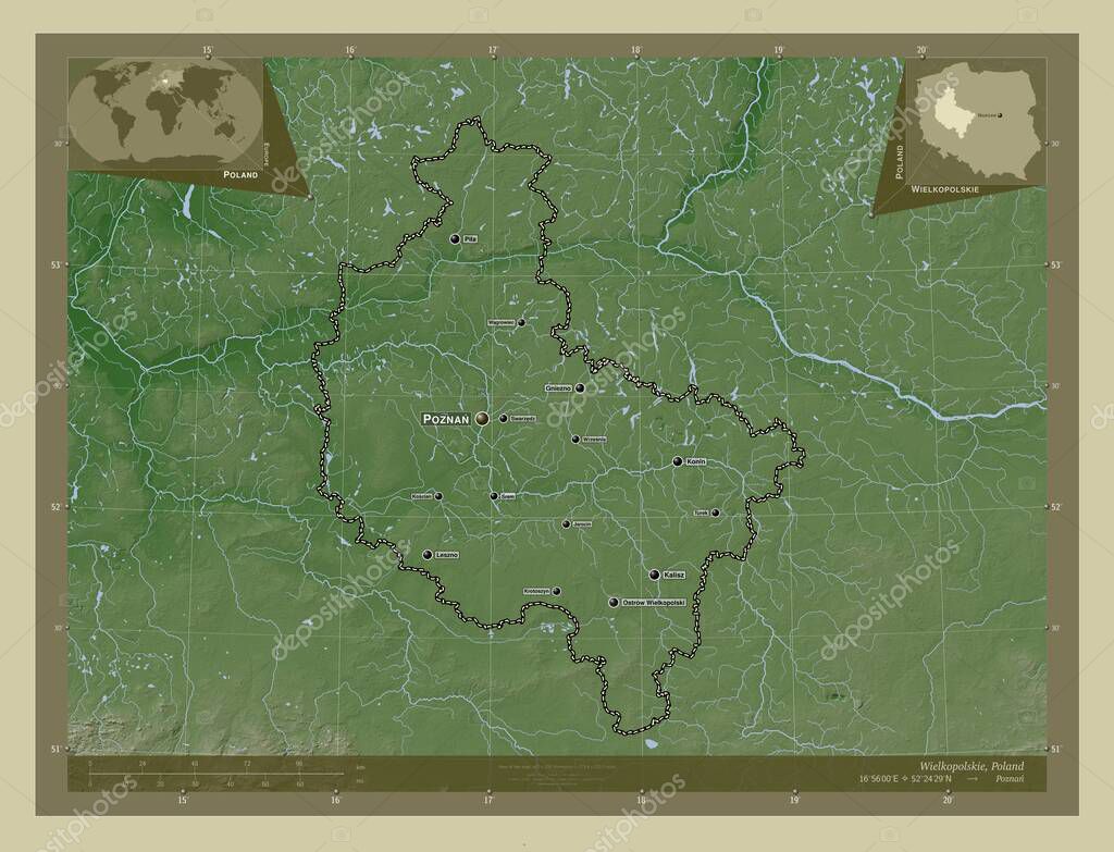
Wielkopolskie, voivodeship|province of Poland. Elevation map colored in wiki style with lakes and rivers. Locations and names of major cities of the region. Corner auxiliary location maps.
Datos de la Imįgen (tiene derechos de autor*)
- Fotografķa:
Wielkopolskie, voivodeship|province of Poland. Elevation map colored in wiki style with lakes and rivers. Locations and names of major cities of the region. Corner auxiliary location maps
- Autor:
- Ancho original:
4930 pķxeles.
- Altura original:
3770 pķxeles.
- Tamańo:
18.59 megapķxeles.
- Categorķas:
- Palabras Clave:
jarocina SREM swarzedz Ostrow wielkopolski estereogrįfico océano turek frontera geografķa Zoom: Kalisz Atlas lubón Gniezno Poznan Wielkopolskie Capital social wagrowiec Continente paķs mundo forma krotoszyn contorno kosciano Europa Naturaleza división administrativa Territorio mapa región Ciencia Leszno Pila voivodato Polonia provincia esquema tierra rizesnia planeta Tierras POL Leyenda benzalina .
Popularidad
- Vistas:
- 0
- Descargas:
- 0
Fotos similares
Otros temas con fotografķas que le puede interesar
- mapa
- Ciencia
- paķs
- Continente
- Zoom:
- wagrowiec
- jarocina
- tierra
- Pila
- Leszno
- Territorio
- krotoszyn
- rizesnia
- forma
- turek
- provincia
- esquema
- Europa
- estereogrįfico
- Polonia
- océano
- planeta
- contorno
- kosciano
- POL
- Naturaleza
- división administrativa
- Leyenda
- geografķa
- Poznan
- Atlas
- Kalisz
- Wielkopolskie
- Ostrow wielkopolski
- Tierras
- mundo
- Gniezno
- SREM
- lubón
- benzalina
- swarzedz
- frontera
- Capital social
- región
- voivodato
(*) Sitio para adquirir: Link externo para Comprar
Fotografķa de Wielkopolskie, voivodeship|province of Poland. Elevation map colored in wiki style with lakes and rivers. Locations and names of major cities of the region. Corner auxiliary location maps, que incluye Wielkopolskie, voivodeship|province of Poland. Elevation map colored in wiki style with lakes and rivers. Locations and names of major cities of the region. Corner auxiliary location maps.
Todas las imįgenes por Depositphotos
Este sitio usa imįgenes de Depositphotos