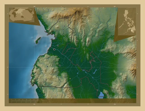
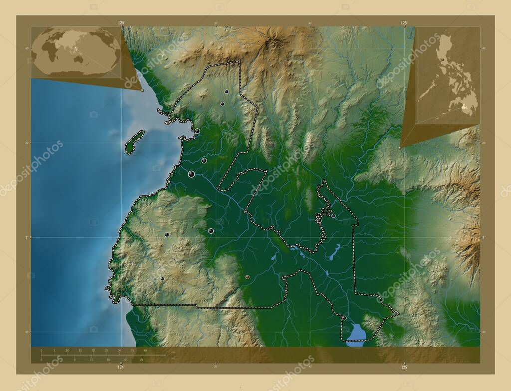
Maguindanao, province of Philippines. Colored elevation map with lakes and rivers. Locations of major cities of the region. Corner auxiliary location maps
Esta foto
Maguindanao, province of Philippines. Colored elevation map with lakes and rivers. Locations of major cities of the region. Corner auxiliary location maps.
Datos de la Imßgen (tiene derechos de autor*)
- FotografÝa:
Maguindanao, province of Philippines. Colored elevation map with lakes and rivers. Locations of major cities of the region. Corner auxiliary location maps
- Autor:
- Ancho original:
4930 pÝxeles.
- Altura original:
3770 pÝxeles.
- Tama˝o:
18.59 megapÝxeles.
- CategorÝas:
- Palabras Clave:
datu montawal south upi estereogrßfico forma shariff aguak north upi buluan sultßn kudarat Naturaleza ciudad de cotabato regiˇn pagalungan divisiˇn administrativa planeta Territorio Tierras Filipinas Asia datu odin sinsuat frontera Parang Continente geografÝa contorno maguindanao Ciencia tierra paÝs mapa Manila Leyenda Capital social ocÚano barira Atlas provincia buldon esquema mundo phl Zoom: .
Popularidad
- Vistas:
- 0
- Descargas:
- 0
Fotos similares
Otros temas con fotografÝas que le puede interesar
- regiˇn
- Territorio
- buluan
- Asia
- barira
- Continente
- north upi
- contorno
- esquema
- datu odin sinsuat
- Capital social
- Parang
- tierra
- Naturaleza
- ciudad de cotabato
- Filipinas
- mapa
- phl
- planeta
- pagalungan
- Ciencia
- sultßn kudarat
- ocÚano
- south upi
- maguindanao
- paÝs
- shariff aguak
- Manila
- geografÝa
- buldon
- estereogrßfico
- datu montawal
- frontera
- divisiˇn administrativa
- forma
- Tierras
- provincia
- Atlas
- Zoom:
- mundo
- Leyenda
(*) Sitio para adquirir: Link externo para Comprar
FotografÝa de Maguindanao, province of Philippines. Colored elevation map with lakes and rivers. Locations of major cities of the region. Corner auxiliary location maps, que incluye Maguindanao, province of Philippines. Colored elevation map with lakes and rivers. Locations of major cities of the region. Corner auxiliary location maps.
Todas las imßgenes por Depositphotos