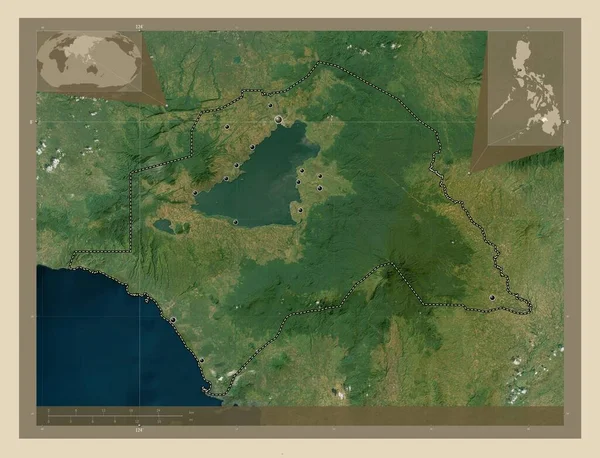
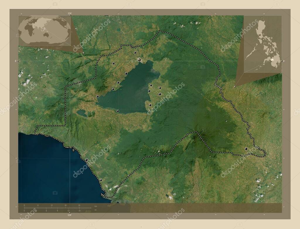
Lanao del Sur, province of Philippines. High resolution satellite map. Locations of major cities of the region. Corner auxiliary location maps
Esta foto
Lanao del Sur, province of Philippines. High resolution satellite map. Locations of major cities of the region. Corner auxiliary location maps.
Datos de la Im·gen (tiene derechos de autor*)
- FotografÌa:
Lanao del Sur, province of Philippines. High resolution satellite map. Locations of major cities of the region. Corner auxiliary location maps
- Autor:
- Ancho original:
4930 pÌxeles.
- Altura original:
3770 pÌxeles.
- TamaÒo:
18.59 megapÌxeles.
- CategorÌas:
- Palabras Clave:
saguiaran ocÈano mapa contorno marantao Manila tugaya balabagan Woo maguing divisiÛn administrativa bayang esquema Leyenda masiu mundo provincia piagapo ciudad de marawi balindong lanao del sur phl taraka regiÛn planeta forma Filipinas Ciencia frontera Zoom: Tierras lumba bayabao Atlas Asia Continente tierra madalum Naturaleza tamparan Capital social malabang paÌs estereogr·fico Territorio geografÌa .
Popularidad
- Vistas:
- 0
- Descargas:
- 0
Fotos similares
Otros temas con fotografÌas que le puede interesar
- Manila
- provincia
- Woo
- tugaya
- contorno
- divisiÛn administrativa
- Filipinas
- Naturaleza
- lanao del sur
- tamparan
- mundo
- malabang
- forma
- geografÌa
- paÌs
- bayang
- saguiaran
- Territorio
- ocÈano
- piagapo
- estereogr·fico
- marantao
- Leyenda
- Atlas
- regiÛn
- maguing
- Tierras
- masiu
- balindong
- Capital social
- taraka
- ciudad de marawi
- balabagan
- Asia
- Continente
- lumba bayabao
- tierra
- esquema
- phl
- planeta
- madalum
- mapa
- frontera
- Ciencia
- Zoom:
(*) Sitio para adquirir: Link externo para Comprar
FotografÌa de Lanao del Sur, province of Philippines. High resolution satellite map. Locations of major cities of the region. Corner auxiliary location maps, que incluye Lanao del Sur, province of Philippines. High resolution satellite map. Locations of major cities of the region. Corner auxiliary location maps.
Todas las im·genes por Depositphotos