JPG
Esta foto
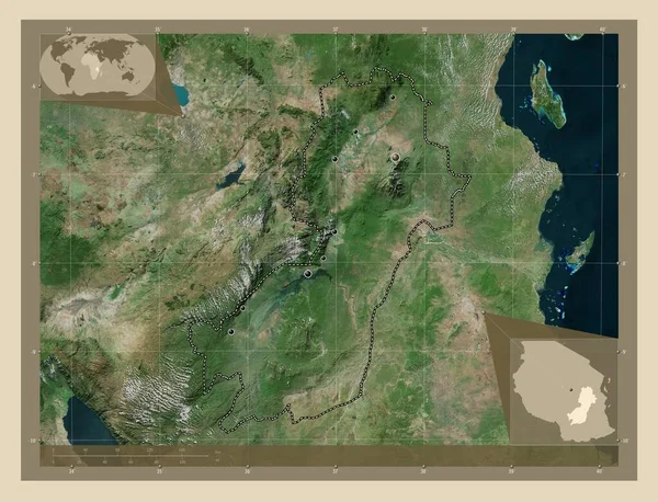
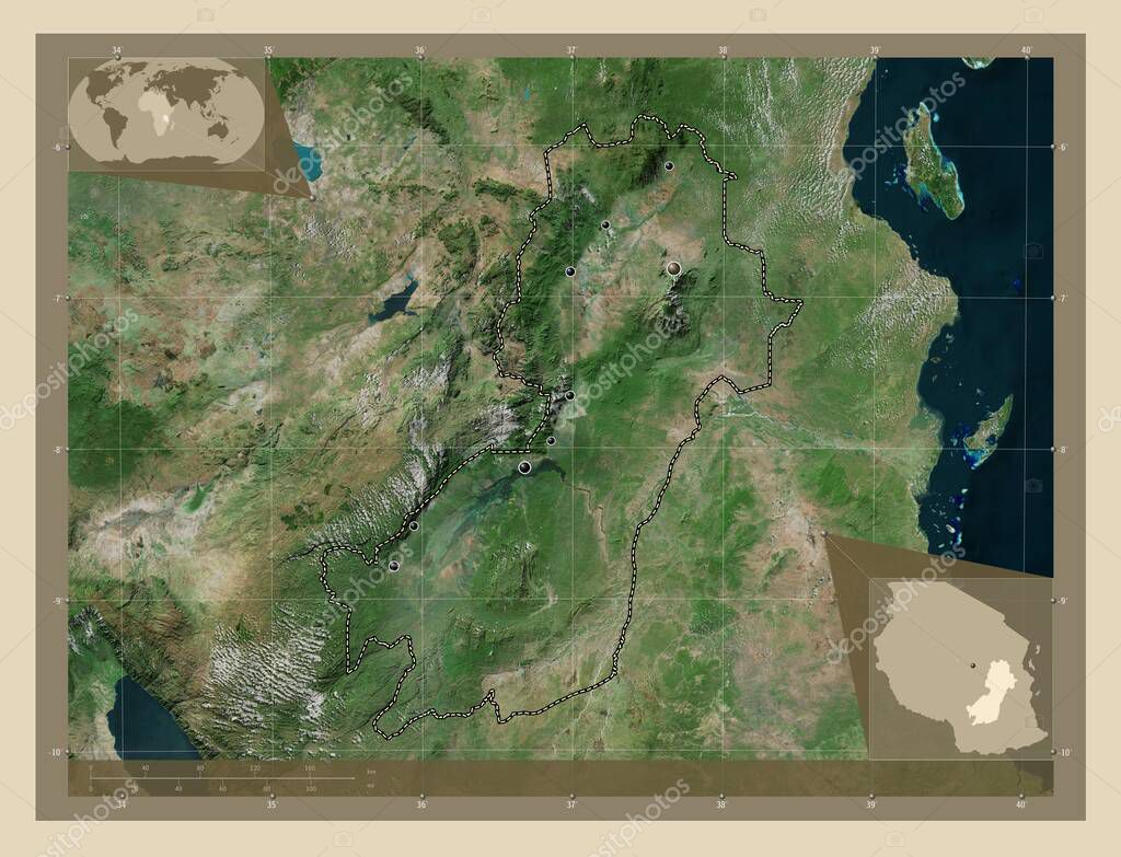
Morogoro, region of Tanzania. High resolution satellite map. Locations of major cities of the region. Corner auxiliary location maps.
Datos de la Imßgen (tiene derechos de autor*)
- FotografÝa:
Morogoro, region of Tanzania. High resolution satellite map. Locations of major cities of the region. Corner auxiliary location maps
- Autor:
- Ancho original:
4930 pÝxeles.
- Altura original:
3770 pÝxeles.
- Tama˝o:
18.59 megapÝxeles.
- CategorÝas:
- Palabras Clave:
Territorio tza estereogrßfico madizini Naturaleza Morogoro divisiˇn administrativa geografÝa planeta contorno esquema mapa paÝs forma msowero Dodoma mundo Ciencia Leyenda ifakara Chita ┴frica mlimba Zoom: kiberege Continente Capital social regiˇn Atlas kilosa Tierras tierra ocÚano ruaha Tanzania frontera .
Popularidad
- Vistas:
- 0
- Descargas:
- 0
Fotos similares
Otros temas con fotografÝas que le puede interesar
- geografÝa
- kilosa
- mapa
- madizini
- Naturaleza
- Territorio
- Ciencia
- ruaha
- tza
- regiˇn
- Morogoro
- mlimba
- Atlas
- msowero
- tierra
- contorno
- Tanzania
- frontera
- Leyenda
- kiberege
- mundo
- esquema
- Capital social
- Dodoma
- ocÚano
- Zoom:
- paÝs
- Continente
- planeta
- estereogrßfico
- ifakara
- Chita
- divisiˇn administrativa
- forma
- ┴frica
- Tierras
(*) Sitio para adquirir: Link externo para Comprar
FotografÝa de Morogoro, region of Tanzania. High resolution satellite map. Locations of major cities of the region. Corner auxiliary location maps, que incluye Morogoro, region of Tanzania. High resolution satellite map. Locations of major cities of the region. Corner auxiliary location maps.
Todas las imßgenes por Depositphotos
Este sitio usa imßgenes de Depositphotos