JPG
Esta foto
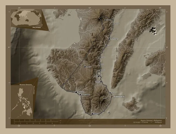
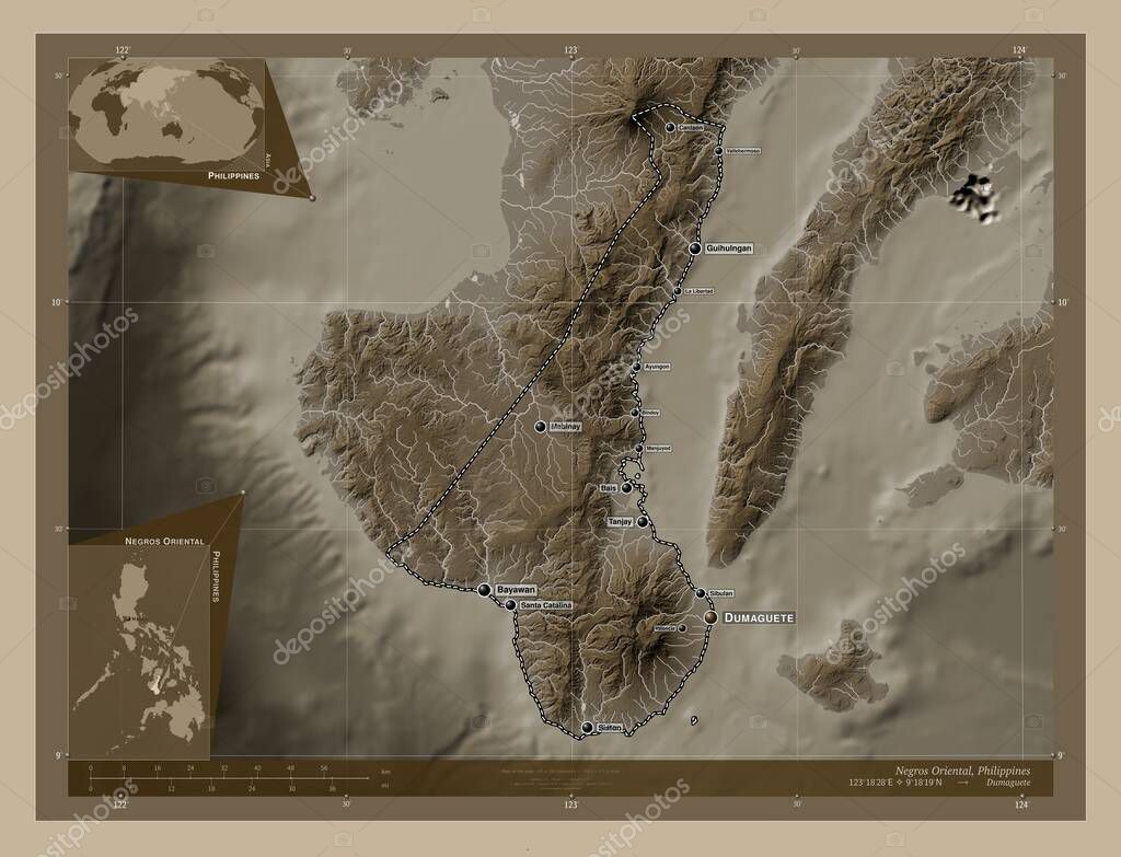
Negros Oriental, province of Philippines. Elevation map colored in sepia tones with lakes and rivers. Locations and names of major cities of the region. Corner auxiliary location maps.
Datos de la Imágen (tiene derechos de autor*)
- Fotografía:
Negros Oriental, province of Philippines. Elevation map colored in sepia tones with lakes and rivers. Locations and names of major cities of the region. Corner auxiliary location maps
- Autor:
- Ancho original:
4930 píxeles.
- Altura original:
3770 píxeles.
- Tamańo:
18.59 megapíxeles.
- Categorías:
- Palabras Clave:
Capital social Territorio Tierras phl región canlaon Negros Oriental Asia contorno bais Dumaguete siaton Atlas Leyenda mapa Ciencia estereográfico santa Catalina bayawan bindoy tanjay Manila Naturaleza océano mundo frontera Filipinas mabinay Continente ayungon esquema división administrativa tierra Sibulan vallehermoso Zoom: geografía Valencia país planeta manjuyod provincia la libertad guihulngan forma .
Popularidad
- Vistas:
- 0
- Descargas:
- 0
Fotos similares
Otros temas con fotografías que le puede interesar
- mabinay
- bais
- Naturaleza
- canlaon
- geografía
- siaton
- provincia
- guihulngan
- Dumaguete
- esquema
- Valencia
- bindoy
- división administrativa
- mundo
- la libertad
- Santa Catalina
- frontera
- país
- Tierras
- phl
- Continente
- forma
- región
- Territorio
- Atlas
- estereográfico
- mapa
- Leyenda
- Capital social
- Negros Oriental
- tierra
- planeta
- océano
- Ciencia
- Zoom:
- Sibulan
- bayawan
- ayungon
- Manila
- Asia
- contorno
- manjuyod
- tanjay
- Filipinas
- vallehermoso
(*) Sitio para adquirir: Link externo para Comprar
Fotografía de Negros Oriental, province of Philippines. Elevation map colored in sepia tones with lakes and rivers. Locations and names of major cities of the region. Corner auxiliary location maps, que incluye Negros Oriental, province of Philippines. Elevation map colored in sepia tones with lakes and rivers. Locations and names of major cities of the region. Corner auxiliary location maps.
Todas las imágenes por Depositphotos
Este sitio usa imágenes de Depositphotos