JPG
Esta foto
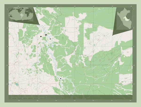
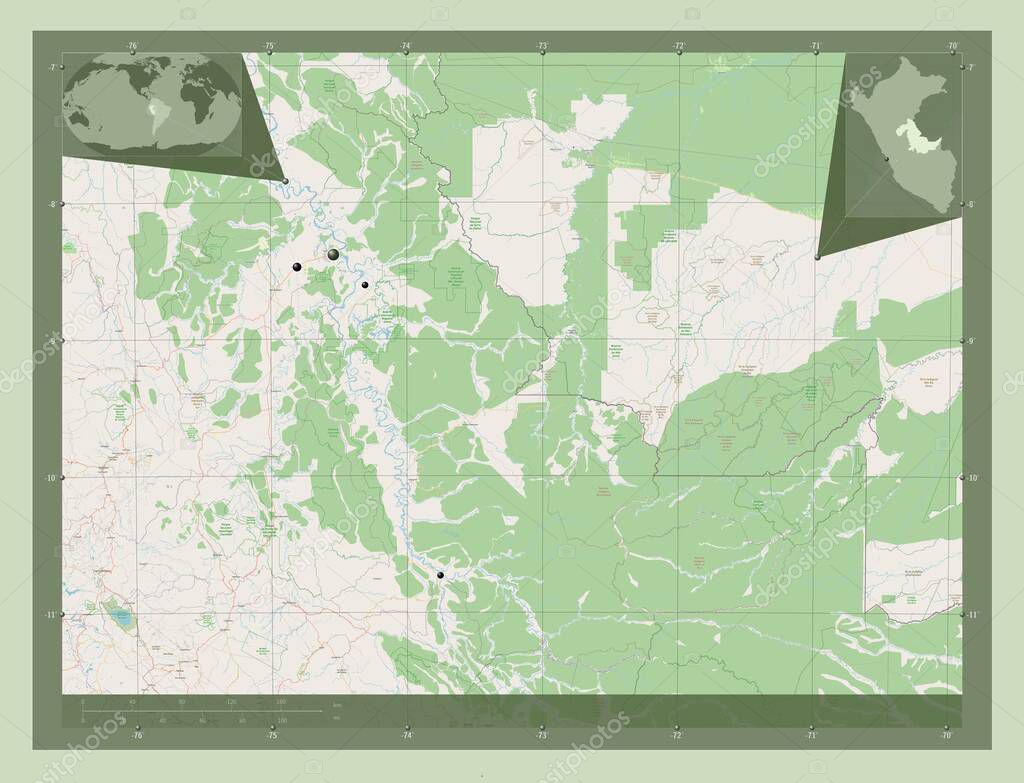
Ucayali, region of Peru. Open Street Map. Locations of major cities of the region. Corner auxiliary location maps.
Datos de la Imįgen (tiene derechos de autor*)
- Fotografķa:
Ucayali, region of Peru. Open Street Map. Locations of major cities of the region. Corner auxiliary location maps
- Autor:
- Ancho original:
4930 pķxeles.
- Altura original:
3770 pķxeles.
- Tamańo:
18.59 megapķxeles.
- Categorķas:
- Palabras Clave:
masisea tierra Por división administrativa mundo Atalaya contorno mapa Leyenda perś campo verde frontera estereogrįfico Zoom: paķs región pucallpa geografķa ucayali Capital social América del Sur planeta forma Tierras Lima Continente Territorio Naturaleza Atlas océano Ciencia esquema .
Popularidad
- Vistas:
- 0
- Descargas:
- 0
Fotos similares
Otros temas con fotografķas que le puede interesar
- Territorio
- esquema
- contorno
- Ciencia
- estereogrįfico
- mundo
- Capital social
- campo verde
- planeta
- Zoom:
- Leyenda
- tierra
- región
- Lima
- Atalaya
- Continente
- división administrativa
- Tierras
- masisea
- frontera
- océano
- forma
- perś
- pucallpa
- Atlas
- América del Sur
- Naturaleza
- geografķa
- Por
- ucayali
- mapa
- paķs
(*) Sitio para adquirir: Link externo para Comprar
Fotografķa de Ucayali, region of Peru. Open Street Map. Locations of major cities of the region. Corner auxiliary location maps, que incluye Ucayali, region of Peru. Open Street Map. Locations of major cities of the region. Corner auxiliary location maps.
Todas las imįgenes por Depositphotos
Este sitio usa imįgenes de Depositphotos