JPG
Esta foto
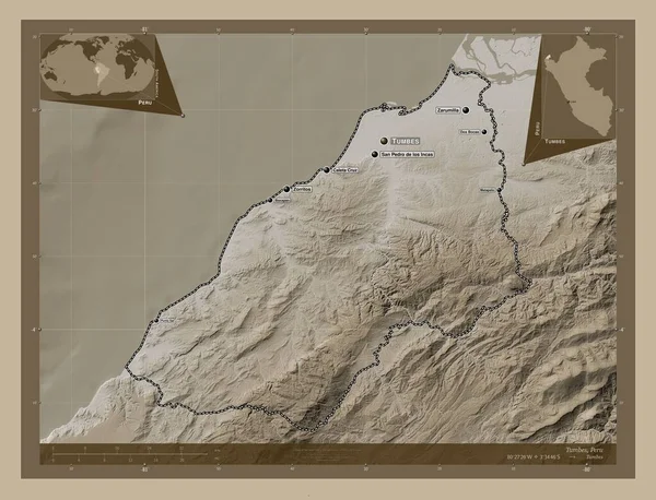
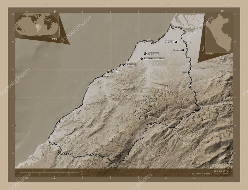
Tumbes, region of Peru. Elevation map colored in sepia tones with lakes and rivers. Locations and names of major cities of the region. Corner auxiliary location maps.
Datos de la Imágen (tiene derechos de autor*)
- Fotografía:
Tumbes, region of Peru. Elevation map colored in sepia tones with lakes and rivers. Locations and names of major cities of the region. Corner auxiliary location maps
- Autor:
- Ancho original:
4930 píxeles.
- Altura original:
3770 píxeles.
- Tamańo:
18.59 megapíxeles.
- Categorías:
- Palabras Clave:
planeta contorno dos bocas zorritos esquema distrito de aguas verdes país aguas verdes Capital social Leyenda perú región san pedro de los incas Zoom: tumbes geografía bocapan Tierras América del Sur Lima Territorio división administrativa Matapalo Ciencia Continente frontera forma océano Naturaleza mapa estereográfico punta sal mundo caleta cruz zarumilla tierra Por Atlas .
Popularidad
- Vistas:
- 0
- Descargas:
- 0
Fotos similares
Otros temas con fotografías que le puede interesar
- aguas verdes
- Continente
- tumbes
- Territorio
- Tierras
- Capital social
- frontera
- división administrativa
- Naturaleza
- caleta cruz
- mapa
- región
- Por
- Matapalo
- estereográfico
- zarumilla
- zorritos
- Lima
- país
- forma
- san pedro de los incas
- Zoom:
- perú
- Atlas
- Ciencia
- América del Sur
- tierra
- mundo
- Leyenda
- dos bocas
- punta sal
- geografía
- esquema
- bocapan
- contorno
- océano
- planeta
- distrito de aguas verdes
(*) Sitio para adquirir: Link externo para Comprar
Fotografía de Tumbes, region of Peru. Elevation map colored in sepia tones with lakes and rivers. Locations and names of major cities of the region. Corner auxiliary location maps, que incluye Tumbes, region of Peru. Elevation map colored in sepia tones with lakes and rivers. Locations and names of major cities of the region. Corner auxiliary location maps.
Todas las imágenes por Depositphotos
Este sitio usa imágenes de Depositphotos