JPG
Esta foto
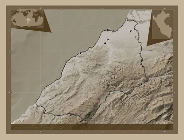
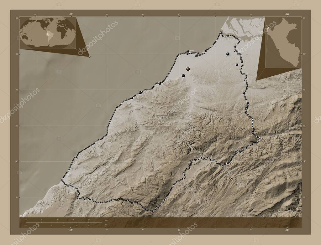
Tumbes, region of Peru. Elevation map colored in sepia tones with lakes and rivers. Locations of major cities of the region. Corner auxiliary location maps.
Datos de la ImŠgen (tiene derechos de autor*)
- FotografŪa:
Tumbes, region of Peru. Elevation map colored in sepia tones with lakes and rivers. Locations of major cities of the region. Corner auxiliary location maps
- Autor:
- Ancho original:
4930 pŪxeles.
- Altura original:
3770 pŪxeles.
- TamaŮo:
18.59 megapŪxeles.
- CategorŪas:
- Palabras Clave:
planeta Amťrica del Sur Por Naturaleza Ciencia estereogrŠfico esquema frontera contorno ocťano Capital social bocapan dos bocas distrito de aguas verdes divisiůn administrativa perķ Lima tierra Continente aguas verdes Tierras paŪs san pedro de los incas Zoom: Atlas caleta cruz geografŪa Leyenda regiůn punta sal forma zarumilla zorritos mundo tumbes Territorio Matapalo mapa .
Popularidad
- Vistas:
- 0
- Descargas:
- 0
Fotos similares
Otros temas con fotografŪas que le puede interesar
- geografŪa
- Ciencia
- tierra
- tumbes
- caleta cruz
- Amťrica del Sur
- paŪs
- contorno
- divisiůn administrativa
- Lima
- frontera
- esquema
- Atlas
- perķ
- Por
- dos bocas
- Zoom:
- punta sal
- zarumilla
- aguas verdes
- ocťano
- mapa
- Territorio
- Tierras
- san pedro de los incas
- planeta
- regiůn
- Matapalo
- mundo
- Capital social
- forma
- Continente
- Naturaleza
- distrito de aguas verdes
- bocapan
- estereogrŠfico
- Leyenda
- zorritos
(*) Sitio para adquirir: Link externo para Comprar
FotografŪa de Tumbes, region of Peru. Elevation map colored in sepia tones with lakes and rivers. Locations of major cities of the region. Corner auxiliary location maps, que incluye Tumbes, region of Peru. Elevation map colored in sepia tones with lakes and rivers. Locations of major cities of the region. Corner auxiliary location maps.
Todas las imŠgenes por Depositphotos
Este sitio usa imŠgenes de Depositphotos