JPG
Esta foto
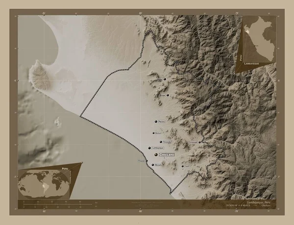
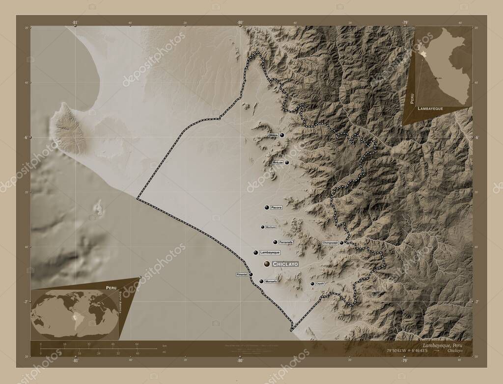
Lambayeque, region of Peru. Elevation map colored in sepia tones with lakes and rivers. Locations and names of major cities of the region. Corner auxiliary location maps.
Datos de la Imßgen (tiene derechos de autor*)
- FotografĒa:
Lambayeque, region of Peru. Elevation map colored in sepia tones with lakes and rivers. Locations and names of major cities of the region. Corner auxiliary location maps
- Autor:
- Ancho original:
4930 pĒxeles.
- Altura original:
3770 pĒxeles.
- Tama±o:
18.59 megapĒxeles.
- CategorĒas:
- Palabras Clave:
regi¾n mochumi mundo picsi Lambayeque patapo tierra Lima Por Zoom: mapa Naturaleza Tierras Chiclayo cayalti frontera per· Leyenda Continente forma Ciencia esquema chongoyape planeta motupe Capital social contorno divisi¾n administrativa paĒs Atlas estereogrßfico Territorio ocķano Amķrica del Sur Olmos geografĒa Pacora pimentel monsefu .
Popularidad
- Vistas:
- 2
- Descargas:
- 0
Fotos similares
Otros temas con fotografĒas que le puede interesar
- contorno
- Chiclayo
- Lambayeque
- Olmos
- Por
- divisi¾n administrativa
- Continente
- Territorio
- Naturaleza
- esquema
- Amķrica del Sur
- monsefu
- regi¾n
- picsi
- tierra
- Capital social
- per·
- forma
- Zoom:
- mundo
- planeta
- Ciencia
- patapo
- estereogrßfico
- Pacora
- Leyenda
- chongoyape
- Tierras
- geografĒa
- mapa
- pimentel
- frontera
- paĒs
- ocķano
- mochumi
- Lima
- Atlas
- cayalti
- motupe
(*) Sitio para adquirir: Link externo para Comprar
FotografĒa de Lambayeque, region of Peru. Elevation map colored in sepia tones with lakes and rivers. Locations and names of major cities of the region. Corner auxiliary location maps, que incluye Lambayeque, region of Peru. Elevation map colored in sepia tones with lakes and rivers. Locations and names of major cities of the region. Corner auxiliary location maps.
Todas las imßgenes por Depositphotos
Este sitio usa imßgenes de Depositphotos