JPG
Esta foto
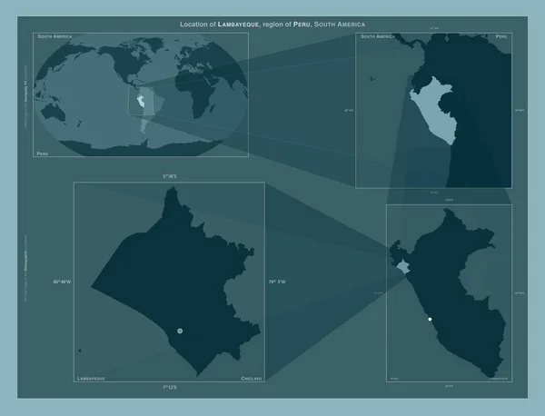
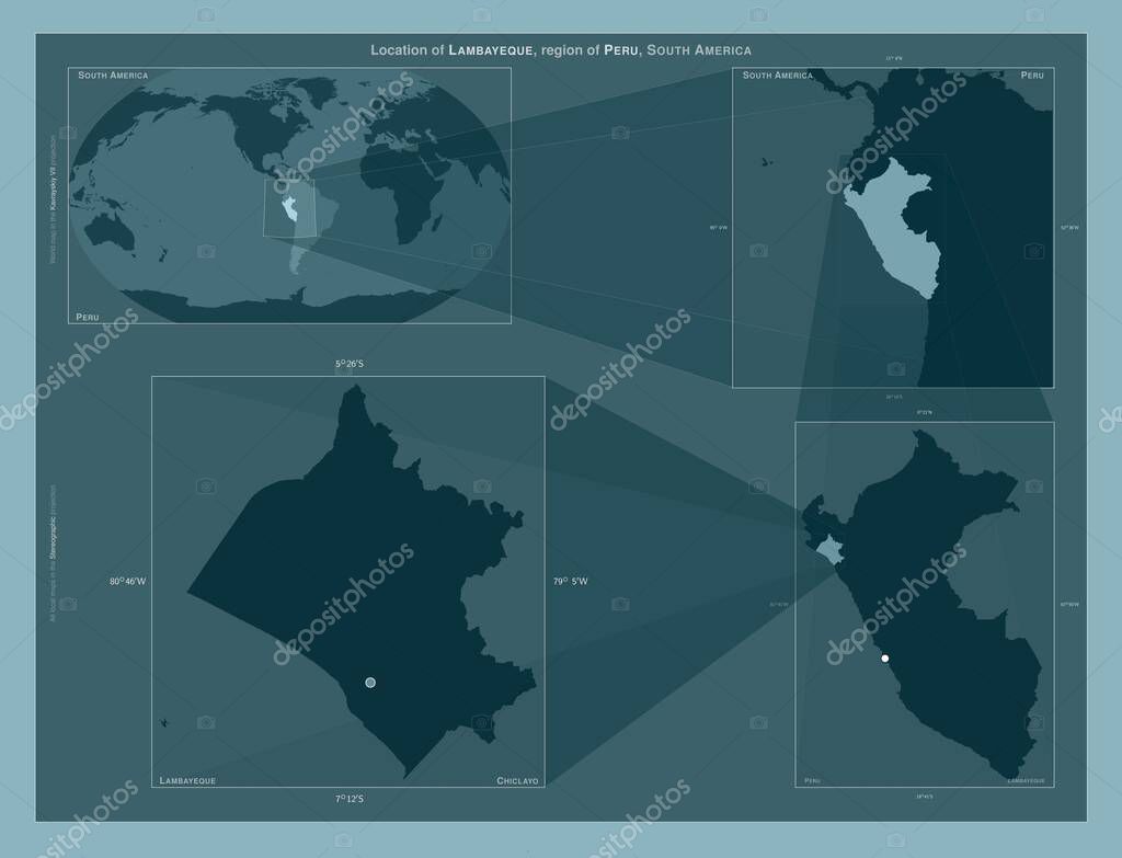
Lambayeque, region of Peru. Diagram showing the location of the region on larger-scale maps. Composition of vector frames and PNG shapes on a solid background.
Datos de la Imįgen (tiene derechos de autor*)
- Fotografķa:
Lambayeque, region of Peru. Diagram showing the location of the region on larger-scale maps. Composition of vector frames and PNG shapes on a solid background
- Autor:
- Ancho original:
4930 pķxeles.
- Altura original:
3770 pķxeles.
- Tamańo:
18.59 megapķxeles.
- Categorķas:
- Palabras Clave:
forma frontera Tierras océano Atlas Lambayeque Naturaleza región Por paķs división administrativa planeta contorno perś esquema Ciencia Leyenda mundo geografķa Territorio Lima estereogrįfico tierra Continente Chiclayo mapa Capital social Zoom: América del Sur .
Popularidad
- Vistas:
- 0
- Descargas:
- 0
Fotos similares
Otros temas con fotografķas que le puede interesar
- tierra
- Atlas
- paķs
- forma
- planeta
- perś
- Naturaleza
- Tierras
- Capital social
- frontera
- mapa
- Leyenda
- contorno
- estereogrįfico
- Ciencia
- América del Sur
- Lima
- mundo
- región
- geografķa
- división administrativa
- Por
- océano
- Zoom:
- Continente
- Lambayeque
- Territorio
- Chiclayo
- esquema
(*) Sitio para adquirir: Link externo para Comprar
Fotografķa de Lambayeque, region of Peru. Diagram showing the location of the region on larger-scale maps. Composition of vector frames and PNG shapes on a solid background, que incluye Lambayeque, region of Peru. Diagram showing the location of the region on larger-scale maps. Composition of vector frames and PNG shapes on a solid background.
Todas las imįgenes por Depositphotos
Este sitio usa imįgenes de Depositphotos