JPG
Esta foto
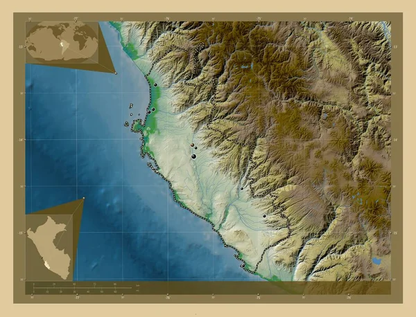
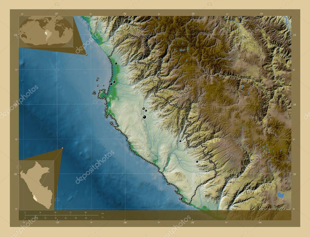
Ica, region of Peru. Colored elevation map with lakes and rivers. Locations of major cities of the region. Corner auxiliary location maps.
Datos de la Imßgen (tiene derechos de autor*)
- FotografÝa:
Ica, region of Peru. Colored elevation map with lakes and rivers. Locations of major cities of the region. Corner auxiliary location maps
- Autor:
- Ancho original:
4930 pÝxeles.
- Altura original:
3770 pÝxeles.
- Tama˝o:
18.59 megapÝxeles.
- CategorÝas:
- Palabras Clave:
Capital social chincha alta San Clemente ocÚano Por ICA Palpa Nasca Santiago geografÝa Lima Leyenda alto laran Zoom: divisiˇn administrativa subtanjalla regiˇn los aquijes Pisco Territorio paÝs frontera contorno mapa mundo Ciencia estereogrßfico AmÚrica del Sur planeta esquema san juan de marcona per˙ Tierras forma Atlas Naturaleza Continente tierra .
Popularidad
- Vistas:
- 0
- Descargas:
- 0
Fotos similares
Otros temas con fotografÝas que le puede interesar
- mapa
- Zoom:
- planeta
- tierra
- divisiˇn administrativa
- Atlas
- contorno
- regiˇn
- Capital social
- estereogrßfico
- San Clemente
- Por
- subtanjalla
- per˙
- Continente
- frontera
- san juan de marcona
- mundo
- paÝs
- esquema
- chincha alta
- forma
- Santiago
- Tierras
- ocÚano
- Naturaleza
- Lima
- ICA
- Pisco
- Ciencia
- Territorio
- alto laran
- Palpa
- AmÚrica del Sur
- Nasca
- los aquijes
- Leyenda
- geografÝa
(*) Sitio para adquirir: Link externo para Comprar
FotografÝa de Ica, region of Peru. Colored elevation map with lakes and rivers. Locations of major cities of the region. Corner auxiliary location maps, que incluye Ica, region of Peru. Colored elevation map with lakes and rivers. Locations of major cities of the region. Corner auxiliary location maps.
Todas las imßgenes por Depositphotos
Este sitio usa imßgenes de Depositphotos