JPG
Esta foto
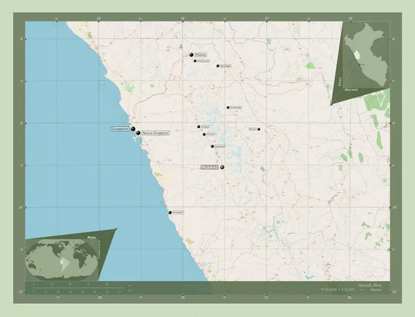
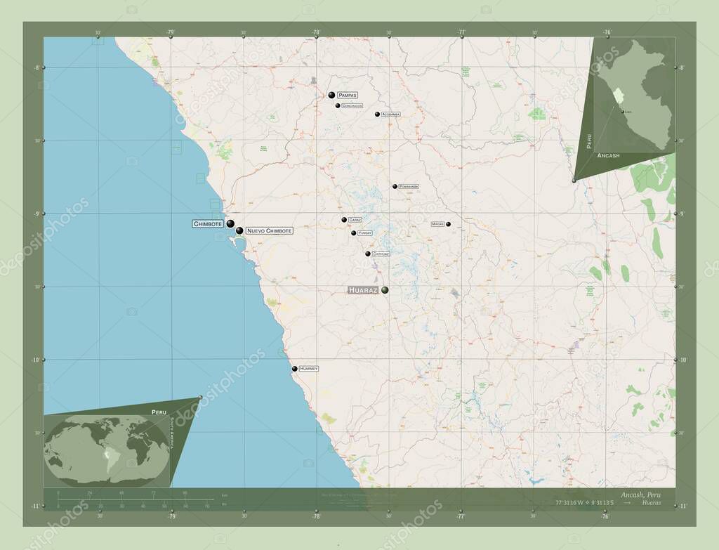
Ancash, region of Peru. Open Street Map. Locations and names of major cities of the region. Corner auxiliary location maps.
Datos de la ImŠgen (tiene derechos de autor*)
- FotografŪa:
Ancash, region of Peru. Open Street Map. Locations and names of major cities of the region. Corner auxiliary location maps
- Autor:
- Ancho original:
4930 pŪxeles.
- Altura original:
3770 pŪxeles.
- TamaŮo:
18.59 megapŪxeles.
- CategorŪas:
- Palabras Clave:
frontera planeta divisiůn administrativa Capital social Ciencia perķ Naturaleza Leyenda chimpancť nuevo chimbote pomabamba acobamba Amťrica del Sur Continente Tierras ocťano paŪs Lima Huaraz mapa Territorio Ancash regiůn Caraz forma mirgas Zoom: conchucos geografŪa carash Carhuaz Atlas contorno estereogrŠfico yongay esquema Por Pampa tierra mundo huarmey .
Popularidad
- Vistas:
- 0
- Descargas:
- 0
Fotos similares
Otros temas con fotografŪas que le puede interesar
- Huaraz
- Tierras
- Territorio
- planeta
- huarmey
- perķ
- Continente
- geografŪa
- Carhuaz
- chimpancť
- frontera
- tierra
- carash
- Naturaleza
- Amťrica del Sur
- contorno
- ocťano
- esquema
- Zoom:
- mapa
- acobamba
- pomabamba
- Pampa
- yongay
- Capital social
- Leyenda
- Caraz
- regiůn
- conchucos
- Atlas
- forma
- paŪs
- mundo
- Por
- nuevo chimbote
- estereogrŠfico
- mirgas
- Ciencia
- Lima
- divisiůn administrativa
- Ancash
(*) Sitio para adquirir: Link externo para Comprar
FotografŪa de Ancash, region of Peru. Open Street Map. Locations and names of major cities of the region. Corner auxiliary location maps, que incluye Ancash, region of Peru. Open Street Map. Locations and names of major cities of the region. Corner auxiliary location maps.
Todas las imŠgenes por Depositphotos
Este sitio usa imŠgenes de Depositphotos