JPG
Esta foto
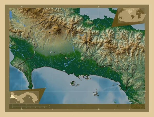
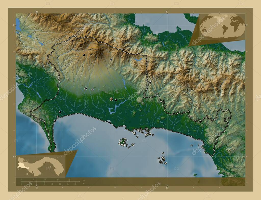
Chiriqui, province of Panama. Colored elevation map with lakes and rivers. Locations of major cities of the region. Corner auxiliary location maps.
Datos de la Imßgen (tiene derechos de autor*)
- FotografÝa:
Chiriqui, province of Panama. Colored elevation map with lakes and rivers. Locations of major cities of the region. Corner auxiliary location maps
- Autor:
- Ancho original:
4930 pÝxeles.
- Altura original:
3770 pÝxeles.
- Tama˝o:
18.59 megapÝxeles.
- CategorÝas:
- Palabras Clave:
contorno mundo AmÚrica del Norte Territorio forma provincia Panamß ChiriquÝ Ciencia bandeja Continente divisiˇn administrativa las lomas puerto armuelles Leyenda esquema alto boquete Capital social tierra el palmar geografÝa David Zoom: Atlas Ciudad de Panamß estereogrßfico planeta mapa regiˇn frontera Naturaleza boquerˇn rodolfo aguilar delgado ocÚano Volcan paÝs Tierras .
Popularidad
- Vistas:
- 1
- Descargas:
- 0
Fotos similares
Otros temas con fotografÝas que le puede interesar
- planeta
- ChiriquÝ
- Panamß
- Ciudad de Panamß
- estereogrßfico
- mapa
- Tierras
- Continente
- contorno
- las lomas
- el palmar
- AmÚrica del Norte
- Volcan
- geografÝa
- provincia
- frontera
- Zoom:
- Capital social
- Naturaleza
- forma
- rodolfo aguilar delgado
- bandeja
- Territorio
- esquema
- boquerˇn
- puerto armuelles
- Leyenda
- tierra
- mundo
- Atlas
- ocÚano
- Ciencia
- alto boquete
- David
- regiˇn
- paÝs
- divisiˇn administrativa
(*) Sitio para adquirir: Link externo para Comprar
FotografÝa de Chiriqui, province of Panama. Colored elevation map with lakes and rivers. Locations of major cities of the region. Corner auxiliary location maps, que incluye Chiriqui, province of Panama. Colored elevation map with lakes and rivers. Locations of major cities of the region. Corner auxiliary location maps.
Todas las imßgenes por Depositphotos
Este sitio usa imßgenes de Depositphotos