EPS
Esta foto
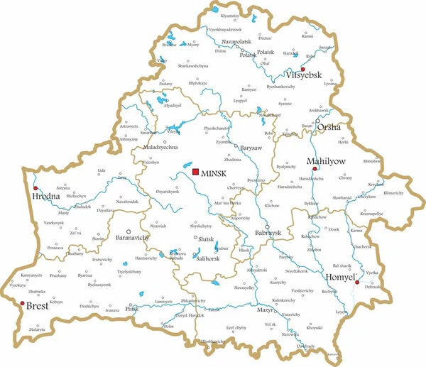
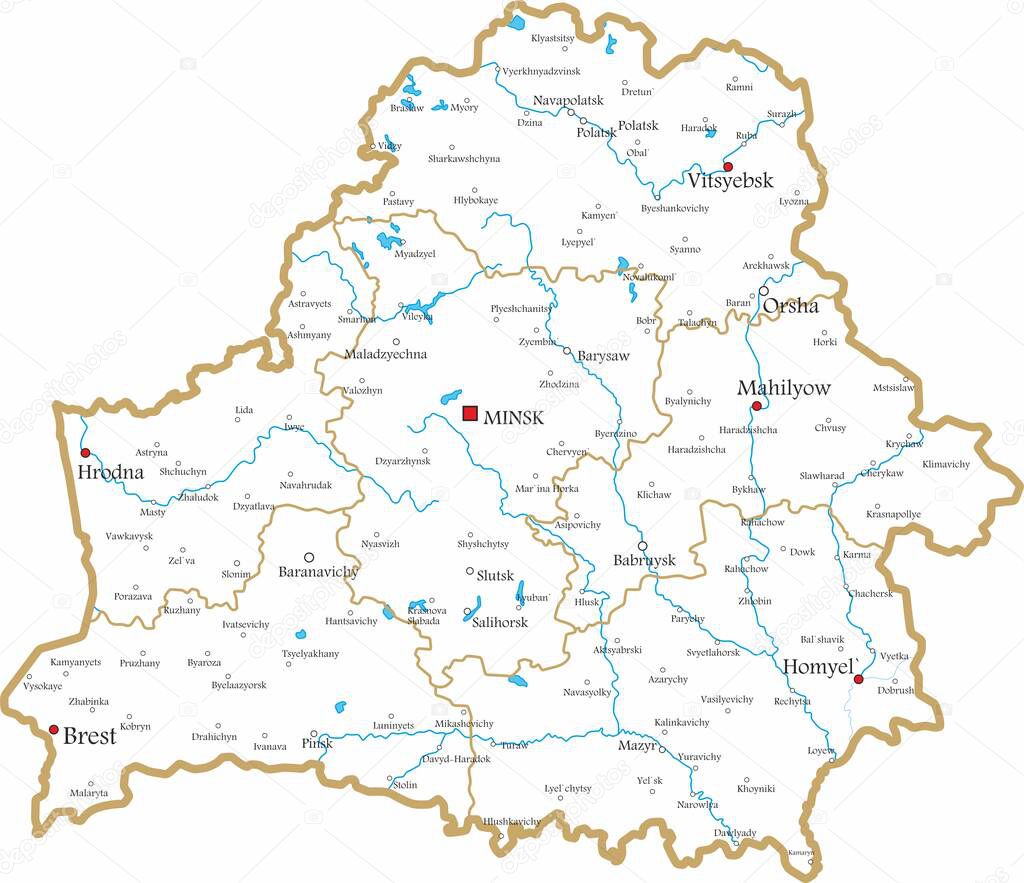
Vector contour administrative map of the Republic of Belarus. The territory of the state with large cities and borders of regions..
Datos de la Imįgen (tiene derechos de autor*)
- Fotografķa:
Vector contour administrative map of the Republic of Belarus. The territory of the state with large cities and borders of regions.
- Autor:
- Ancho original:
8337 pķxeles.
- Altura original:
7190 pķxeles.
- Tamańo:
59.94 megapķxeles.
- Categorķas:
- Palabras Clave:
zona Territorio Emblema nación región paķs Ubicación esquema geografķa silueta cartografķa Topografķa División Color plan a ciudades Administrativo Repśblica Federal de Alemania sķmbolo Colorido turismo viajes piso bielorruso signo Belarśs europeo bielorrusia geogrįfico Grįfico Europa Continente RUSIA ruta Grande frontera Minsk nacional Polķtica Tradicional mapa Tierras viaje Belarśs Mapa ilustración contorno vector estado ciudad .
Popularidad
- Vistas:
- 45
- Descargas:
- 4
Fotos similares
Otros temas con fotografķas que le puede interesar
- Minsk
- Turismo
- Europa
- sķmbolo
- ilustración
- Topografķa
- Repśblica Federal de Alemania
- Grįfico
- Belarśs
- Estado
- Tierras
- geogrįfico
- cartografķa
- Grande
- plan a
- ruta
- Color
- Emblema
- Colorido
- Continente
- Territorio
- Viajes
- paķs
- División
- RUSIA
- ciudad
- Polķtica
- mapa
- ciudades
- nacional
- piso
- bielorrusia
- viaje
- europeo
- contorno
- zona
- Belarśs Mapa
- región
- bielorruso
- frontera
- geografķa
- silueta
- esquema
- Ubicación
- nación
- Administrativo
- Tradicional
- signo
- vector
(*) Sitio para adquirir: Link externo para Comprar
Fotografķa de Vector contour administrative map of the Republic of Belarus. The territory of the state with large cities and borders of regions., que incluye Vector contour administrative map of the Republic of Belarus. The territory of the state with large cities and borders of regions..
Todas las imįgenes por Depositphotos
Este sitio usa imįgenes de Depositphotos