EPS
Esta foto
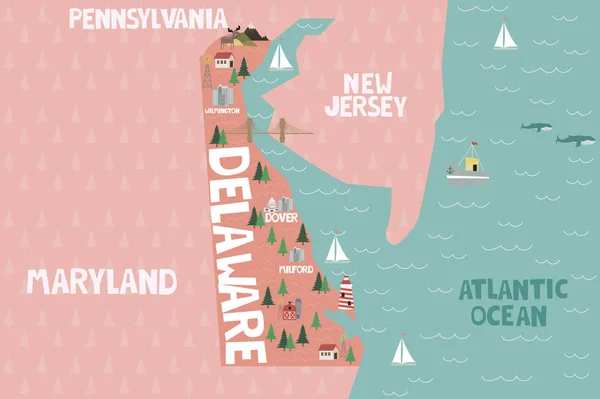
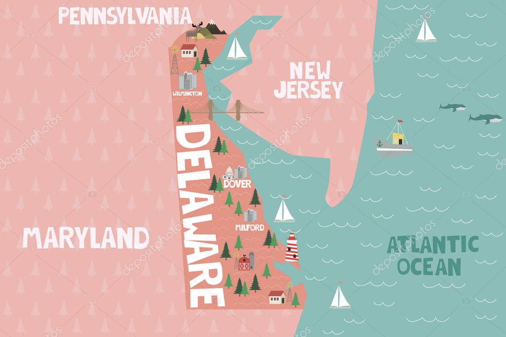
Illustrated map of the state of Delaware in United States with cities and landmarks. Ilustración vectorial editable.
Datos de la Imįgen (tiene derechos de autor*)
- Fotografķa:
Illustrated map of the state of Delaware in United States with cities and landmarks. Ilustración vectorial editable
- Autor:
- Ancho original:
3000 pķxeles.
- Altura original:
1997 pķxeles.
- Tamańo:
5.99 megapķxeles.
- Categorķas:
- Palabras Clave:
Animales ciudad Turista Playa Moderno Milford frontera Grįfico planta Detallado cartografķa arte paķs Naturaleza Imprimible Aislado Parque nacional sķmbolo Capital social Wilmington mapa Mar paisaje geografķa hito Abstracto Rancho Atlįntico tierra lago Delaware piso granja mundo viajes Estados Unidos Dover puertos faro América nativa Construir Bosque Montańa América icono .
Popularidad
- Vistas:
- 160
- Descargas:
- 6
Fotos similares
Otros temas con fotografķas que le puede interesar
- planta
- América
- Capital social
- tierra
- arte
- faro
- Abstracto
- paisaje
- Mar
- Playa
- Viajes
- Grįfico
- granja
- Imprimible
- cartografķa
- Aislado
- icono
- Dover
- paķs
- ciudad
- Delaware
- hito
- lago
- Naturaleza
- frontera
- Moderno
- Rancho
- mundo
- piso
- Construir
- América nativa
- sķmbolo
- Animales
- geografķa
- Montańa
- Atlįntico
- Bosque
- Turista
- mapa
- Milford
- Detallado
- Puertos
- Wilmington
- Estados Unidos
- Parque Nacional
(*) Sitio para adquirir: Link externo para Comprar
Fotografķa de Illustrated map of the state of Delaware in United States with cities and landmarks. Ilustración vectorial editable, que incluye Illustrated map of the state of Delaware in United States with cities and landmarks. Ilustración vectorial editable.
Todas las imįgenes por Depositphotos
Este sitio usa imįgenes de Depositphotos